Auction 088
Gallery Auction - Judaika, Erez Israel, Numismatics, Jewelry, Art and more
By Winner'S
Contact auction house
May 13, 2015
3 Shatner Center 1st Floor Givat Shaul Jerusalem, Israel
Terms of sale
View demo
The auction has ended
|
LOT 267:
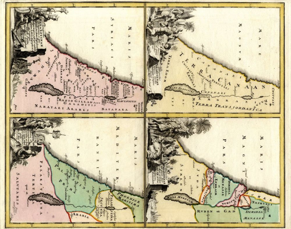
Four maps of the Holy Land on one Sheet. Adrian Reland. Nuremberg, 1720. Colored.
more...
|
|
|
Sold for: $90
Start price:
$
70
Estimated price :
$150 - $200
Buyer's Premium: 20%
VAT: 17%
On commission only
|
Four maps of the Holy Land on one Sheet. Adrian Reland. Nuremberg, 1720. Colored.
Four different maps of the Holy Land on one sheet. Colored, copperplate engravings. According to Adrian Reland. By J.D. Kohler. From: Descriptio orbis antiqvi. Nuremberg, 1720. In the bottom right corner, in the blank margins: “30” – handwritten. Scale: 1:2100000. Latin. Each map measures 18.1×14.3 cm. (sheet measures 45.4×36.8 cm.) Very fine condition. Thick, quality paper. Red, cut edges. Original fold. On the verso, in the blank margins, reinforcement. Aging stains in the blank margins. Order of maps, from right to left, top to bottom:1. . Conspectus Palaestinae uti divisa fuit a Mose et Iosua inter XII. tribus israëliticas per H. Relandum. Map of the Holy Land in twelve tribal divisions.2.Conspectus Palaestinae a priscis incolis inhabitatae tempore Josuae per Hadr. Relan. Map of the Holy Land in Joshua’s times.3. Conspectus Palaestinae divisae in primam, secundam et tertiam ut erat circa initium saeculi aerae Christianae quinti. per H. Rela[nd]u. Holy Land divided into three provinces at the beginning of Christianity. 4. et regionum, in quas distributa fuit stante templo secundo et aliquo tempore post ejus exidium quarum in libris Apogryphis et N.T. scriptisque Iosephi, Eusebii, Hieronymi et Epiphanii sit mentio. per H. Relat.
